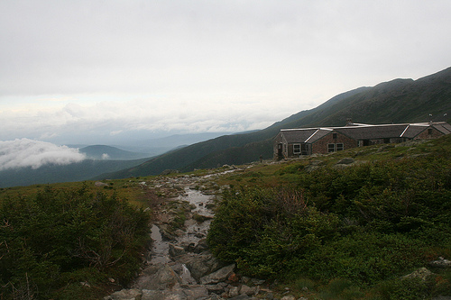
 The conditions weren’t ideal when my wife, Lisa, and I decided to backpack hut-to-hut in the White Mountains in late June. The black flies were still biting and a daily dose of rain had slickened the trails, making that unforgiving White Mountain granite that much more treacherous. By the time we reached the third of the AMC huts, Mizpah Springs, after an incredibly humid day where I really felt my age, I was spent. I had more than enough material to write my story on hut-to-hut hiking in the Whites for The Washington Post and I just wanted to head back to civilization. Conditions needed to be ideal the next morning to walk the historic Crawford Path through the Presidential Range. Once you venture beyond Mizpah Springs Hut to Mount Pierce, you’re above treeline on a ridge walk, entirely exposed to the weather since there’s really nowhere to hide.
Socked in to a large cloud with the threat of lightening the next morning, it was time to head down. Or was it? At a juncture just below the peak of Pierce, we had to make a decision—up or down. That’s when we ran into a couple we befriended the night before, on vacation from Beijing, happy to breathe in the fresh alpine air. “C’mon, I have sardines,” Micah said. The next thing you know we’re atop the ridge, the layers of mist disrobing, and we were treated to views of the bald knob atop Mount Eisenhower. It was like walking on a lunar landscape, bordered by velvety green sedge and moss, often staring in awe at alpine wildflowers in bloom like bog laurel, white bunchberry, and purple fireweed.
Then we spotted the
Lakes of the Clouds hut, our lodging for the night, and its lofty perch atop a 5200-foot ridge with stunning vistas of Mount Washington Hotel below and the Cog Railroad ambling slowly up to the Mount Washington summit. We spent the twilight hours looking at the glorious view and then peering at the twinkling stars above (no light pollution here). The next morning, after a filling breakfast, we climbed on hardscrabble rock the last 1.4 miles to the summit of Mount Washington, New England’s tallest peak. The winds subsided, the sun peeked through the clouds, and we were rewarded with wondrous views of Mounts Jefferson, Adams, and Madison. Lisa and I were elated that we made the decision to continue onward.
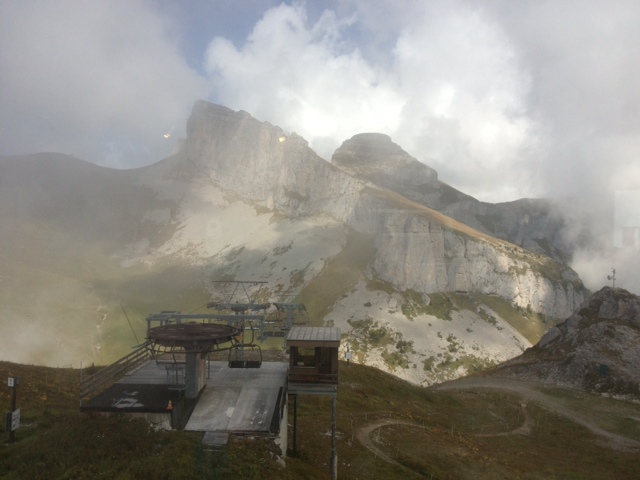 Come winter, Montreux serves as a base for skiers who want the cosmopolitan feel of a city after spending a day on the slopes. It’s only an hour train ride to the exclusive resort town of Gstaad, 90 minutes to Zermatt and the Matterhorn. If you want to stay closer to town, you can simply hop on a train to Aigle and then take the mountain train up to Leysin, a great family ski area. Yesterday we did exactly that to hike up to the top of the ski area and lunch at the revolving restaurant, Le Kuklos. The Swiss trains that climb slowly up the steep mountainside are an engineering marvel, rewarding us with great views of the green valley below.
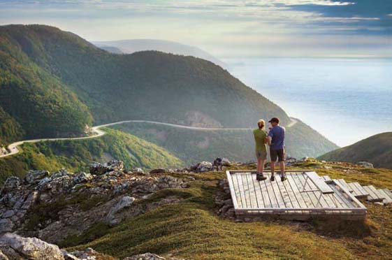 The landscape of Cape Breton is a mesmerizing mix of rolling summits, precipitous cliffs, high headlands, sweeping white sand beaches, and glacially carved lakes, all bordered by the ocean. The Cabot Trail is a road that hugs the Gulf of St. Lawrence on the rugged northwestern edge of Nova Scotia, where around every bend you want to pull over, spew expletives of joy at the stupendous vista, and take another snapshot. Indeed, it’s as close to Big Sur as the East Coast gets. Add bald eagles, moose, coyotes, and pilot whales fluking in the nearby waters and you want to leave the car behind and soak it all up on two legs.
  Piestewa Peak
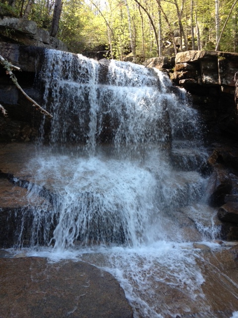 I spent Memorial Day Weekend in the White Mountains with family and friends, finally bagging Mount Chocorua. Standing 3,478-feet high, it doesn’t make the 4,000-foot club and therefore many avid climbers blow it off. They shouldn’t. This is a classic New England climb with an exquisite panorama of the southern Presidential range and enough granite to leave your quads burning by the end of the trek. We took the Champney Falls Trail, named after the artist who painted the distinctive rocky summit of this peak. Within an hour, we reached picturesque Champney Falls and watched the rushing water stream down a series of ledges. Two hours later, after scrambling through rock, we reached the summit, initially socked in a cloud. Once it started to clear up, we were treated to glorious views of the lakes and green valley below, the snow-covered trails of Mt. Washington in the distance.
 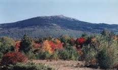 Climbing the broad-shouldered peak Henry David Thoreau called a “sublime mass,” Mt. Monadnock, is a rite of passage for many New England children. Just over the border of Massachusetts in southern New Hampshire, Monadnock is less than a two-hour drive from Boston. Its accessibility and locale, smack dab in the center of New England, has made it one of the two most popular mountain ascents in the world going toe-to-toe with Japan’s Mount Fuji.
 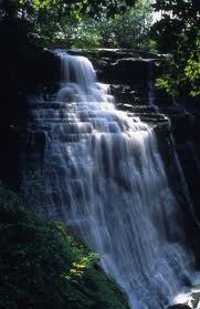 Nestled between Akron and Cleveland along a 22-mile corridor of the Cuyahoga River is one of America’s newest national parks,
 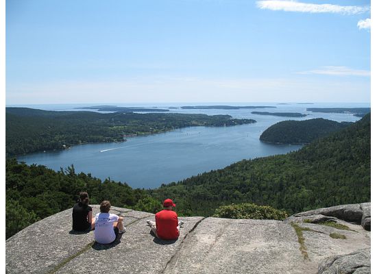 With the highest mountains on the Atlantic coast north of Brazil, slicing fjords, deserted offshore islands, and 41 miles of rugged shoreline, it’s easy to understand why
 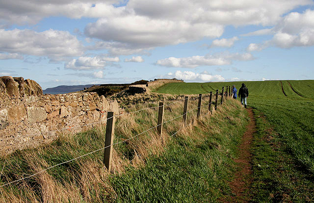 Most folks associate John Muir with his boundless efforts to make Yosemite a national park and as the father of the Sierra Club. Yet, the great naturalist is just as celebrated in his homeland of Scotland. To commemorate the 100th anniversary of Muir’s death in 1914 and as part of the
  The conditions weren’t ideal when my wife, Lisa, and I decided to backpack hut-to-hut in the White Mountains in late June. The black flies were still biting and a daily dose of rain had slickened the trails, making that unforgiving White Mountain granite that much more treacherous. By the time we reached the third of the AMC huts, Mizpah Springs, after an incredibly humid day where I really felt my age, I was spent. I had more than enough material to write
  In 1990, I left my job as an insurance broker in Manhattan and booked a four-month trip to the South Pacific, New Zealand, and Australia. The day before I left on that fateful journey, I was strolling through the Fifth Avenue Book Fair when I found a book titled “Travel Writing, For Profit and Pleasure” by Perry Garfinkel. I did exactly what the author advised, kept a journal when I was away, and when I returned home I sold my first story, “Learning to Scuba Dive in the Cook Islands” to The Miami Herald. It was the start of a prolific travel writing career, where I would write more than 1500 articles and close to a dozen books. Another one of the stories sold from that inaugural journey was